
What are Pictorial Maps?
Ever visited a theme park, zoo or event with a map with drawings and images to show locations, landmarks, and other features? That’s an illustrated map.
These maps simplify complex information, evoke emotion, and make locations memorable. Their blend of art and utility makes them versatile tools for communication and creativity.
In this guide, we cover:
- What is an illustrated map?
- History and evolution of illustrated maps
- What makes an illustrated map special?
- Types and styles of illustrated maps
- Where you’ll find illustrated maps (and why they work)
- Tools and techniques for creating illustrated maps
- Best practices and design tips
Let’s jump in.
What is an Illustrated Map?
Illustrated and pictorial maps, often called “artistic” or “decorative” maps, blend cartography with creative design, making them both functional and visually engaging.
Unlike standard technical maps that focus purely on geographic accuracy, illustrated maps incorporate drawings, icons, symbols, and artistic elements to tell a story or highlight specific aspects of a place. However, the balance between artistic expression and geographic accuracy can vary widely depending on the map’s intended audience and purpose.
Common applications include tourist maps for cities or regions, campus maps for universities, historical maps showing how places looked in different eras, and themed maps focusing on topics like food culture, architecture, or local wildlife.
These maps serve both practical navigation purposes and educational or entertainment value, making geographic information more accessible and memorable through visual storytelling.
History and Evolution of Illustrated Maps
Illustrated maps have a rich history stretching back centuries. Medieval manuscripts featured ornate maps with religious symbolism and mythical creatures, while Renaissance cartographers began incorporating artistic flourishes alongside improved geographic accuracy.
The golden age of pictorial mapping emerged in the 20th century with tourism booms and commercial applications. Today, digital tools have democratised map illustration, allowing artists and businesses to create custom maps more easily than ever before.
What Makes an Illustrated Map Special?
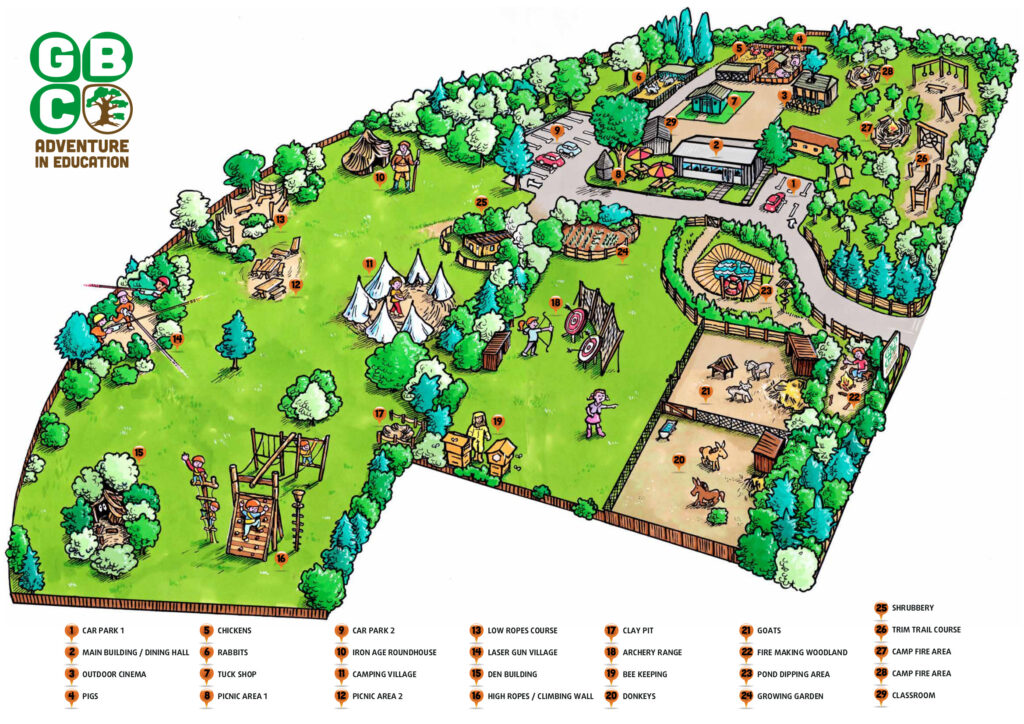
Visual storytelling elements – They often feature hand-drawn buildings, landmarks, people, animals, or cultural symbols that instantly communicate a place’s personality and help viewers form emotional connections.
Artistic style – The cartographer uses creative typography, colour palettes, and illustration techniques that draw the eye and make information easier to digest than dense, technical maps.
Selective emphasis – Rather than showing every street or geographic feature, illustrated maps typically highlight points of interest, cultural attractions, or thematic elements relevant to their purpose.
Multiple perspectives – They might combine bird’s-eye views with side-view illustrations of buildings or landmarks, creating a more dynamic visual experience than standard maps.
Types and Styles of Illustrated Maps
Understanding the different approaches to illustrated mapping can help you choose the right style for your project:
Hand-drawn vs Digital – Traditional hand-drawn maps offer organic charm and unique character, while digital illustrations provide precision and easy editing capabilities.
Isometric Maps – Three-dimensional perspective maps that show buildings and landscapes from an elevated angle, popular for urban areas and campus maps.
Minimalist Style – Clean, simple designs focusing on essential elements with plenty of white space and limited colour palettes.
Fantasy and Fictional Maps – Elaborate artistic creations for imaginary worlds, often featuring decorative borders, compass roses, and mythical elements.
Thematic Maps – Maps organised around specific topics like food trails, historical events, or cultural attractions.
Where You’ll Find Illustrated Maps (And Why They Work)
But where exactly can you find these artistic maps? Let’s explore the variety of places they pop up:
Tourism and Travel
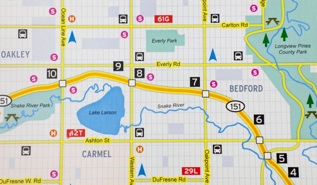
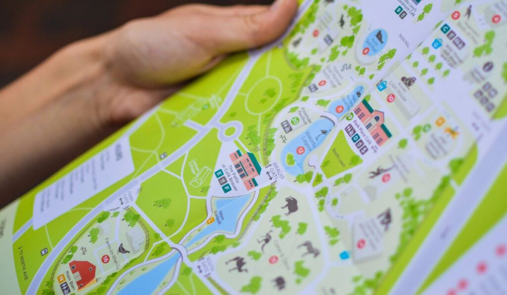
Tourist maps are perhaps the most familiar application, helping visitors navigate cities, national parks, or regions while highlighting attractions, restaurants, hotels, and cultural points of interest. Theme parks like Disney World use detailed illustrated maps showing rides, restaurants, and facilities in an engaging, cartoon-like style that matches their brand identity.
Education and Academia
Schools and universities use illustrated campus maps to help students, faculty, and visitors navigate facilities. Educational publishers incorporate pictorial maps in textbooks and children’s books to teach geography, history, and cultural concepts in a more engaging way than traditional cartography.
Real Estate and Development
Property developers and real estate companies use illustrated site plans and neighbourhood maps to showcase amenities, nearby attractions, and the lifestyle aspects of a location. These maps help potential buyers visualise not just the property layout but the surrounding community.
Marketing and Branding
Businesses create custom illustrated maps as marketing tools to show their location in relation to landmarks, transportation, or other businesses. Event organisers use them for festivals, conferences, or weddings to guide attendees and create memorable keepsakes.
Entertainment and Media
Video games frequently use illustrated maps for game worlds, while movies and TV shows create maps of fictional locations. Publishers use them in fantasy and adventure novels to help readers navigate imaginary realms.
Urban Planning and Architecture
City planners and architects use illustrated maps and diagrams to communicate development proposals to the public, making complex urban planning concepts more accessible to community members during public meetings.
Historical and Cultural Documentation
Museums and historical societies create illustrated maps showing how places looked in different time periods, or highlighting the cultural and historical significance of locations for educational exhibits and publications.
Tools and Techniques for Creating Illustrated Maps
Whether you’re a beginner or an experienced designer, various tools can help bring your illustrated map vision to life:
Digital Software Options:
- Adobe Illustrator – Industry standard for vector-based map illustrations
- Procreate – Popular iPad app for hand-drawn digital maps
- Figma – Web-based design tool excellent for collaborative map projects
- QGIS – Free geographic software that can export data for artistic enhancement
Traditional Methods:
- Pen and ink – Classic approach offering unique texture and character
- Watercolour – Adds organic, flowing elements perfect for natural landscapes
- Mixed media – Combining digital and traditional techniques for unique results
Basic Workflow:
- Research and gather reference materials
- Create rough sketches and plan composition
- Develop the base geographic framework
- Add illustrated elements and details
- Refine typography and colour palette
- Test with target audience and iterate
Best Practices and Design Tips
Creating effective illustrated maps requires balancing artistic vision with practical functionality:
Maintain Spatial Relationships – Even stylised maps should preserve relative distances and directional accuracy to remain functional.
Choose Appropriate Detail Levels – Tourist maps need different levels of detail than campus maps or neighbourhood guides.
Consider Your Audience – Children’s maps benefit from bright colours and cartoon elements, while business applications may require more sophisticated aesthetics.
Typography Matters – Readable fonts and proper hierarchy ensure important information doesn’t get lost in artistic flourishes.
Colour Psychology – Use colours that evoke the right emotions and ensure sufficient contrast for accessibility.
Test Usability – Have real users test your map’s navigation effectiveness before finalising the design.
Creating Illustrated Maps With Image Box Design
If you’re looking to bring a location to life with a custom, illustrated map, we can help. Specialising in custom map illustrations for everything from brochures to websites, we create a unique visual that not only guides but also captivates your audience.
Get in touch with our team today and let’s bring your map to life!
Ready to start your project? Contact Image Box Design today!
Related Guides:
- What is Print Media?
- 7 Reasons Why Illustration Is Important
- What is Graphic Illustration?
- What Is Business Stationery?
- 12 Key Advantages of Print Advertising
- What Makes a Good Poster?
- How to Make a Magazine

